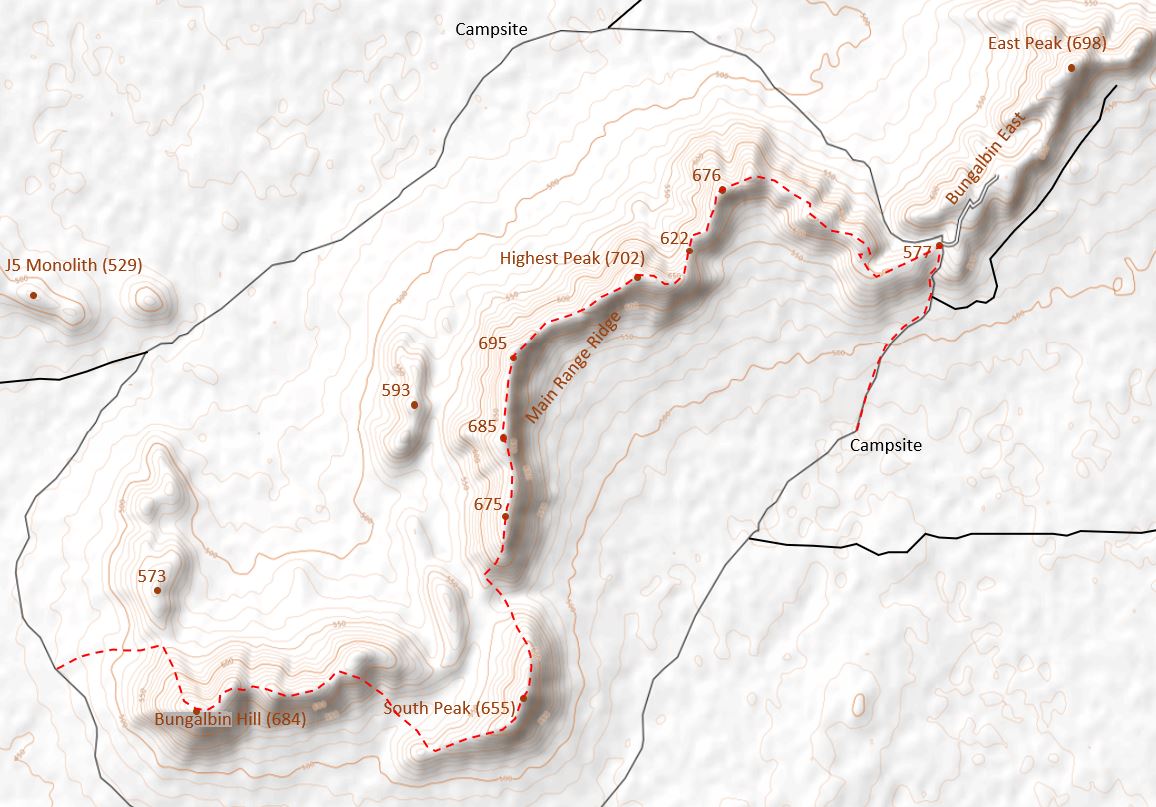
14.9 km, 790 m ascent 
Watch the Video!
The main range ridge walk, as presented here, is just one of several possible variations on the theme. Either a vehicle shuffle is required, since it starts and ends at different points, or it’s a long walk (or cycle) back along the vehicle track.
The walk starts just west of Bungalbin Hill, where there are plenty of parking options just off the main access track circumventing the range. The route first heads approximately due west, aiming to the low saddle separating Bungalbin Hill from a small peak to the north.
From the saddle, the steep north ridge of Bungalbin Hill is ascended, which offers fine views out to the east over the highest part of the range, and also out to J5 in the NW (which has been saved from becoming an open mine pit) and to Mt Jackson on the horizon further west. The summit of Bungalbin Hill itself is rounded and mostly shrouded in vegetation – so no great vistas from the summit itself. However, a large cairn (the only one in the range) marks the highest point.
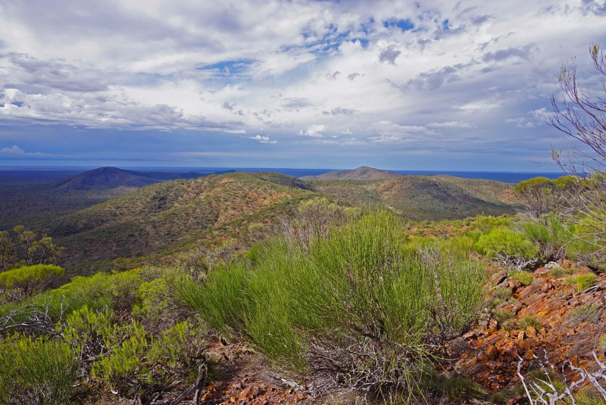
From the summit, head NE, initially through moderately thick vegetation, and after a while drop to a small saddle. As the vegetation thins, there are some fantastic rock outcrops to be enjoyed around here. The ridge east is mostly open and eventually you will reach the start of the steep descent towards the South Peak.
After crossing a valley, commence the short ascent to the end of the west ridge of South Peak. From here it is a steady climb up the ridge line. About midway, a steep rock band must be crossed (not difficult in any way) highlighting the beauty of the BIF rock formation. The summit of South Peak is crossed, but the best viewpoints are just along the ridge to the north. There has been fire activity in this area (probably due to lightning strike) so the vegetation is all low.
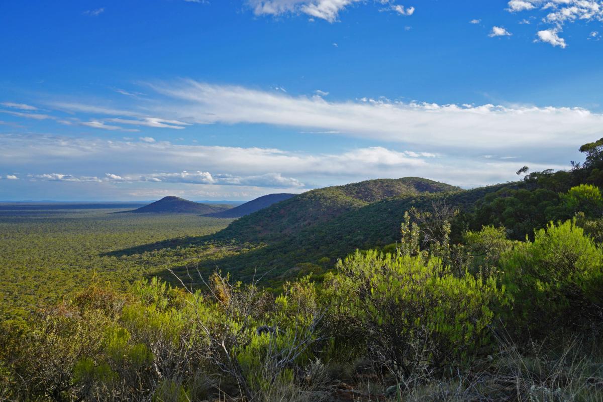
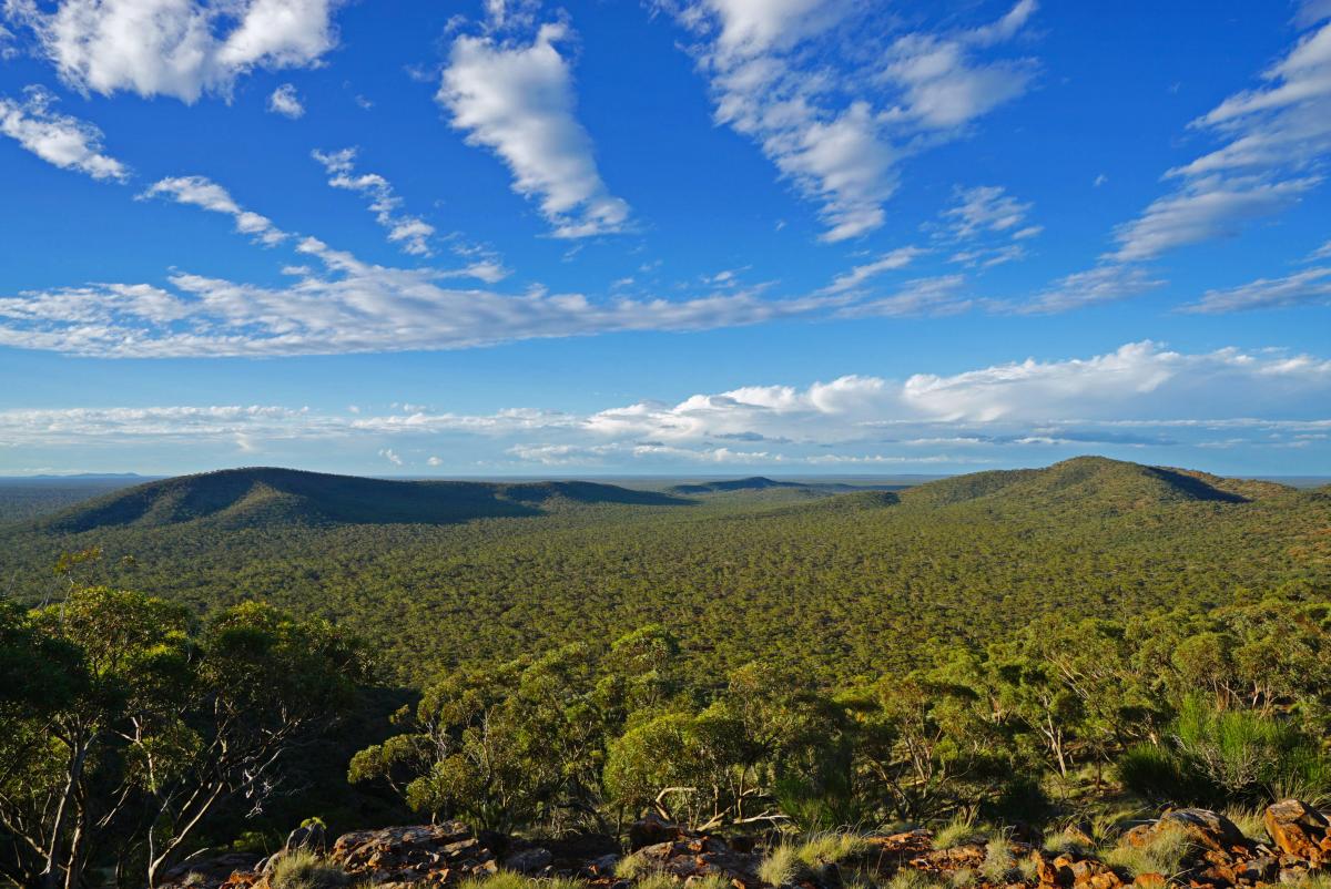
There is an outstanding vista out to the north/ NE, with the main ridge curving in a great arc over to Highest Peak and to East Peak over 6 km away. It is sad to contemplate the desecration of the area surrounding East Peak and on the sand plain below that would have occurred if iron ore mining had been permitted. In the same vicinity there is also a magnificent panorama over Bungalbin Hill and surrounding hills and out as far as the Die Hardy and Mt Manning Ranges on the distant northern horizon.
Descend the open rocky ridge in a generally northerly direction, eventually arriving at the saddle separating South Peak from the central ridge, which comprises most of the highest land in the range. The south ridge is ascended steeply, once again through mostly open but rocky terrain. Shortly after cresting the ridge, the vegetation thickens again, which sets the tone for much of the next few km to the Highest Peak.
There are plenty of fine viewpoints from the ridgeline, but the vegetation often becomes moderately thick. Nowhere is this particularly difficult to traverse but it will slow you down a bit. As a general rule, head to the west/ north side of the ridge if the going gets too tough, since the vegetation cover is generally thinner.
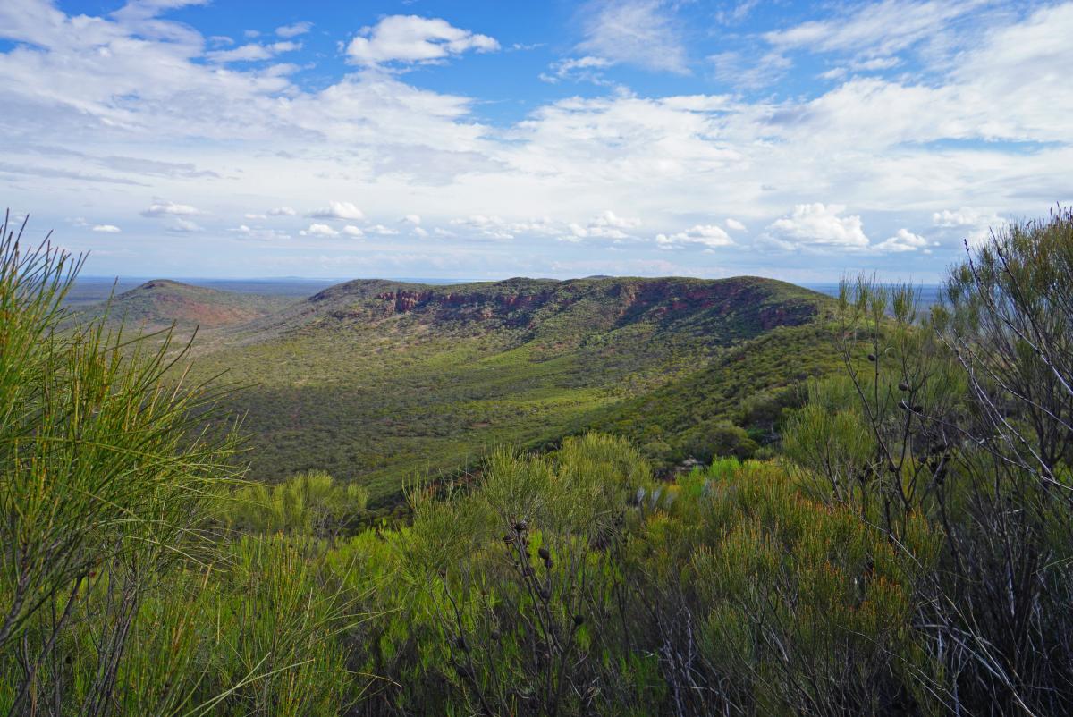
After following this high-level ridge for around 3.5 km, Highest Peak is reached. There are no views from the summit itself, since it is shrouded in some of the thickest vegetation in the entire range. However, with careful exploration it should be possible to locate some fine viewpoints just to the west of the summit looking back along the ridgeline you have ascended. Moving just to the north of the summit, there are also fine viewpoints looking over the twisting ridgeline ahead and over to North Peak, NE Peak and East Peak.
A lovely spot for lunch! Now follow the ridge downhill to a saddle, first SE and then in a generally NE direction, before ascending once again to another couple of high points. The ridge then continues SE clambering down and up one further high point, before finally starting the long descent to the vehicle crossing saddle that separates the central Main Range Ridge from the Bungalbin East ridge.
On the way down there are magnificent viewpoints where you can look back to South Peak over much of the the route you have walked today, and also offering outstanding vistas to the NE and east. At the saddle your days work is mostly done. As presented here, the walk then follows the steep and rutted track southwards, back to the unofficial southern campsite. The walk could also be conducted using the northern campsite as a base, in which case you would follow the track down in the other direction.