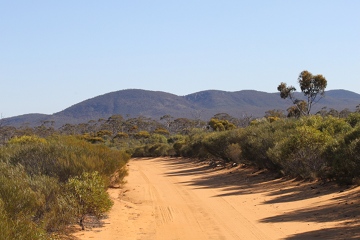
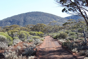
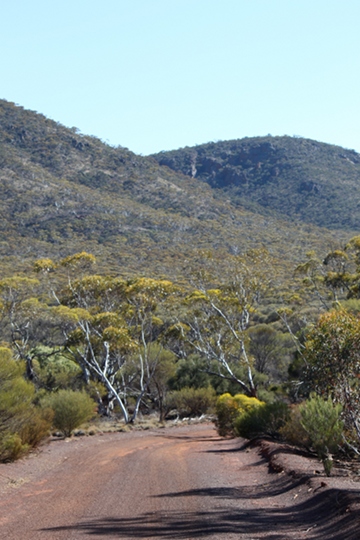
Biological Surveys
During the period 1972 to 1995 there were two major surveys that recorded the vegetation and / or fauna of Helena and Aurora Range. These surveys were conducted by the Western Australian Museum and Department of Conservation and Land Management (CALM)*. Since 2000, surveys conducted on Helena and Aurora Range have included the work of Environmental Consultants, on behalf of Mining Companies, as well as the Department of Environment and Conservation (DEC)*, Scientists and students at Murdoch University and University of Western Australia as well as a citizen science project conducted by BirdLife Australia.
List of Biological surveys conducted on Helena and Aurora Range
1972
John Beard mapped the vegetation communities of Helena and Aurora Range on a scale of 1:250,000 developed from aerial photography, soil survey data and on site observation.
- Beard JS (1972) The vegetation of the Jackson Area, Western Australia. Vegmap, Perth.
1971-1981
Western Australian Museum (WA Museum) and Department of Conservation and Land Management (CALM)* conducted a survey at Mt Jackson Range (15 km radius) and Bungalbin Hill (10 km radius) including birds, mammals, reptiles and amphibians (John Dell and R.A. How), as well as plant species and vegetation communities (Ken Newbey and R.J.Hnatiuk) as part of a survey over an area including the Jackson map sheet and western half of the Kalgoorlie map sheet
- Dell J, Howe RA, Newbey KR and Hnatiuk RJ (1985) Physical environment. In: The biological survey of the Eastern Goldfields of Western Australia. Part 3 Jackson-Kalgoorlie study area. Records of the Western Australian Museum Supplement 23:5-10.
- Newbey KR and Hnatiuk RJ (1985) Vegetation and Flora In: The biological survey of the Eastern Goldfields of Western Australia. Part 3 Jackson-Kalgoorlie study area. Records of the Western Australian Museum Supplement 23: 11-38.
- Dell J, and How RA (1985) Vertebrate Fauna In: The biological survey of the Eastern Goldfields of Western Australia. Part 3 Jackson-Kalgoorlie study area. Records of the Western Australian Museum Supplement 23: 39-66.
1995
Department of Conservation and Land Management (CALM) conducted a botanical survey of Helena and Aurora Range (Neil Gibson, Michael Lyons and Brendan Lepschi) and fauna survey of Helena and Aurora Range including birds, mamals and reptiles (Andrew Chapman and Grant Pronk) as well as an invertebrate survey (R.P. McMillan).
- Chapman A and Pronk G (1995) Vertebrate, Invertebrate and Flora survey of the Helena and Aurora Range, Eastern Goldfields, Western Australia. Part 3 Vertebrate Fauna. Unpublished CALM Report.
- Chapman A and Pronk G (1997) Part 3 Vertebrate Fauna. In Lyons MN and Chapman A (eds) A Biological Survey of the Helena and Aurora Range, Eastern Goldfields Western Australia. Unpublished CALM Report for Environment Australia, Canberra.
- Gibson N, Lyons MN and Lepschi BJ (1997) Part 2 Vegetation and Flora. In Lyons MN and Chapman A (eds) A Biological Survey of the Helena and Aurora Range, Eastern Goldfields Western Australia. Unpublished CALM Report for Environment Australia, Canberra.
- Gibson N, Lyons MN and Lepschi BJ (1997) Flora and vegetation of the Eastern Goldfields Ranges, Part 1: Helena and Aurora Range. CALMScience 2: 231-246.
- Lyons MN and Chapman A (1996) A Biological Survey of the Helena Aurora Range, Eastern Goldfields Western Australia. Report for the Biodiversity Group, Western Australia.
- Lyons MN and Chapman A (eds.) (1997) A Biological Survey of the Helena and Aurora Range, Eastern Goldfields Western Australia. Unpublished Report for Environment Australia, Canberra.
- McMillan RP (1997) Part 4 Invertebrate Fauna. In Lyons MN and Chapman A (eds) A Biological Survey of the Helena and Aurora Range, Eastern Goldfields Western Australia. Unpublished CALM Report for Environment Australia, Canberra.
2001
Mattiske Consulting Pty Ltd and Ecologia conducted botanical surveys at Mt Jackson Range, Windarling Range, Die Hardy Range, Helena and Aurora Range, Koolyanobbing Range and Highclere Hills for Portman Iron Ore Limited.
- Ecologia Environment (2002) Koolyanobbing Iron Ore Expansion Project. Public Environmental Review. Consultants report Prepared for Portman Iron Ore Limited, Perth.
2004-2006
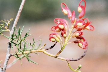
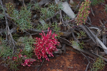
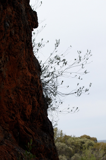
In Western Australia, studies on Tetratheca species including Tetratheca aphylla subsp. aphylla (endemic to Helena and Aurora Range) have included genetic and taxonomic studies (Ryonen Butcher), and a population study of four Tetratheca species growing on BIF ranges included Tetratheca aphylla subsp. aphylla on Helena and Aurora Range (Yates et al. 2011, Department Environment and Conservation, DEC)
- Yates CJ, Gibson N, Pettit NE, Dillon R and Palmer R (2011) The ecological relationship and demography of restricted ironstone endemic plant species: implications for conservation. Australian Journal of Botany. 59 (7) 692-700.
- Butcher R (2007) New taxa of 'leafless' Tetratheca (Elaeocarpaceae, formerly Tremendraceae) from Western Australia. Australian Systematic Botany 20 (2) 139-160.
- Butcher R, Byrne M and Crayn DM (2007) Evidence of convergent evolution among phylogenetically distant rare species of Tetratheca (Elaeocarpaceae, formerly Tremendraceae) from Western Australia. Australian Systematic Botany. 20 (2) 126-138.
2006-2007
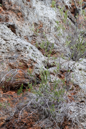
A project was initiated by Department of Environment and Conservation (DEC) to resolve the taxonomy of unnamed vascular plant taxa in Western Australia so that the scientific descriptions and names of these plants could be published, particularly for those that may be vulnerable to future mining activitues, as part of the 'Saving Our Species' biodiversity conservation initiative. In particular, the Banded Ironstone Formation (BIF) Ranges of the Yilgarn Craton were targeted as well as Ravensthorpe Range and Bandalup Hill. All mineral rich areas with increasing pressures from prospective mining activity. Plant species described that occurred on Helena and Aurora Range included Lepidodperma bungalbin (endemic to Helena and Aurora Range), Lepidosperma ferricola, Leucopogon spectablis (endemic to Helena and Aurora Range) and Neurachne annularis (known from Helena and Aurora Range and Mt Manning).
- Barrett RL (2007) New species of Lepidosperma (Cyperaceae) associated with banded ironstone in southern Western Australia. Nuytsia. 17: 37-60.
- Hislop M and Chapman AR (2007) Three new and geographically restricted species of Leucopogon (Ericaceae: Styphelioideae: Styphelieaea) from south-west Western Australia. Nuytsia. 17: 165-184.
- Macfarlane TD (2007) A new species of Neurachne (Poaceae) from Western Australia. Nuytsia. 17: 215-222.
2010
A Troglofauna survey was conducted at sites within the Hunt Range, one site 'near' Helena and Aurora Range (south of the main range) and some sites along Mount Finnerty Range by Bennelongia Pty Ltd for Polaris Metals Pty Ltd.
- Bennelongia Environmental Consultants (2011) Yilgarn Iron Ore Project: Troglofauna Surveys. Report prepared by Andrew Trotter for Polaris Metals Pty Ltd, August 2011, Report 2011/119.
Birds in the Great Western Woodlands - community citizen science project
2012-2024
BirdLife Australia in partnership with The Nature Conservancy initiated and funded the project Birds in the Great Western Woodlands in 2011. Bird surveys were conducted from 2012 to 2014 and a report on the findings published in May 2016. This project is now run by the branch BirdLife Western Australia and over seen by the BirdLife WA's Great Western Woodlands Committee. Helena and Aurora Range is one of the nine locations (survey areas), that were initially surveyed each season (from 2012 to 2014) and now twice a year in autumn and spring by a team of volunteer birdwatchers. See Other Associates for more details, time of surveys and contact information. Bird watchers and naturalists of all skill levels are always welcome to join these surveys. For background information on this project visit the Great Western Woodlands project on the BirdLife Australia website.
- Fox E, Douglas T (2016) Birds of the Great Western Woodlands. BirdLife Australia, Melbourne. 16pp
- Fox E, McNee S, Douglas T (2016) Birds in the Great Western Woodlands. Report for The Nature Conservancy. BirdLife Australia, Melbourne. 245pp
Biological Surveys on other BIF Ranges of the Yilgarn Craton
Rangeland vegetation condition surveys
1992-1993
The Department of Agriculture and Foods in Western Australia (AgWA) conducts rangeland vegetation condition surveys that provides vegetation maps, climate information and more. The surveys of thirteen rangeland areas have been published to date. The last remaining rangeland survey has been recently initiated for the Southern Goldfields Region, which includes Helena and Aurora Range. The rangeland survey that is closest to Helena and Aurora Range is the Pastoral Survey of the Sandsrone - Yalgoo - Paynes Find area, surveyd in 1992-1993 and published in 1998. This survey goes in to the very northern edge of the Great Western Woodlands, just missing Helena and Aurora Range. Much of the information presented in Sandsrone - Yalgoo - Paynes Find area report has relevance to the Southern Goldfields region.
- Payne AL, Van Vreeswyk AME, Pringle HJR, Leighton KA and Hennif P (1998) An Inventory and Condition Survey of the Sandstone-Yalgoo-Paynes Find area Western Australia. Technical Bulletin No. 90. Agriculture Western Australia.
BIF Floristic Surveys in the Yilgarn
1995-1996
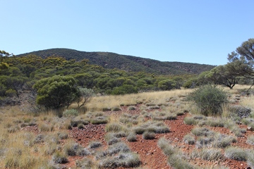
The Department of Conservation and Land Management (CALM) conducted flora and vegetation surveys of BIF ranges in the Yilgarn during 1995 and 1996 as part of a project funded under the National Estate Program, a Commonwealth-financed grants scheme administered by the Australian Heritage Commissin (Federal Government) and the Heritage Council of WA (State Government). The ranges surveyed during this period included Mount Manning Range, Hunt Range, Yendilberin and Watt Hills, Highclere Hills, Bremer Range, Parker Range, Middle and South Ironcap, Digger Rock and Hatter Hill as well as Helena and Aurora Range.
- Gibson N and Lyons MN (1997) Floristic Survey of the Mt Manning Range of the Eastern Goldfields of Western Australia. Unpublished Report for the Australian Heritage Commisssion prepared by Department of Conservation and Land Management.
- Gibson N and Lyons MN (1997) Floristic Survey of the Hunt Range, Yendilberin and Watt Hills of the Eastern Goldfields of Western Australia. Unpublished Report for the Australian Heritage Commisssion prepared by Department of Conservation and Land Management.
- Gibson N and Lyons MN (1997) Floristic Survey of the Highclere Hills of the Eastern Goldfields of Western Australia. Unpublished Report for the Australian Heritage Commisssion prepared by Department of Conservation and Land Management.
- Gibson N and Lyons MN (1997) Floristic Survey of the Middle and South Ironcap, Digger Rocks and Hatter Hill of the Eastern Goldfields of Western Australia. Unpublished Report for the Australian Heritage Commisssion prepared by Department of Conservation and Land Management.
- Gibson N and Lyons MN (1998) Flora and vegetation of the Eastern Goldfields Ranges: Part 2. Bremer Range. Journal of the Royal Society of Western Australia, 81:107-117.
- Gibson N and Lyons MN (1998) Flora and vegetation of the Eastern Goldfields Ranges: Part 3. Parker Range. Journal of the Royal Society of Western Australia, 81:119-129.
- Gibson N and Lyons MN (2001) Flora and vegetation of the Eastern Goldfields Ranges: Part 4. Highclere Hills. Journal of the Royal Society of Western Australia, 84:71-81.
- Gibson N and Lyons MN (2001) Flora and vegetation of the Eastern Goldfields Ranges: Part 5. Hunt Range, Yendilberin and Watt Hills. Journal of the Royal Society of Western Australia, 84:129-142.
- Gibson N (2004) Flora and vegetation of the Eastern Goldfields Ranges: Part 6. Mt Manning Range. Journal of the Royal Society of Western Australia, 87:35-47.
- Gibson N (2004) Flora and vegetation of the Eastern Goldfields Ranges: Part 7. Middle and South Ironcap, Digger Rock and Hatter Hill. Journal of the Royal Society of Western Australia, 87:49-62.
2005-2008
The Department of Environment and Conservation (DEC) conducted floristic surveys of other banded ironstone formation ranges within the Yilgarn Craton in more recent years. This was a Science Division Research Project within the DEC and was referred to as Floristic surveys of the banded ironstone formation (BIF) ranges of the Yilgarn. Between 2005 and 2008, 24 ranges were surveyed (source; DEC website 5 May 2012). The results are published within the DEC journal Conservation Science of Western Australia (previously known as CALMScience).
Within the Strategic Review (2008), 18 ranges were reported as surveyed or going to be surveyed. These were: Jack Hills, Weld Range, Koolanooka Hills, Mt Karara / Mungada Ridge / Blue Hills, Minjar / Gnows Nest, Warriedar Hill / Pinyalling and Mt Gibson in 2005; Booylgoo Range, Bulga Downs, Cashmere Downs, Wolla Wolla / Gullewa, Wiluna West and Robinson Range in 2006, Perrinvale / Wallering Range, Brooking Hills, Mt Mason and Mt Hope, Yalgoo, Die Hardy Range, Lake Giles, Mt Dugel/ Mt Nairn in 2007.
- Meissner R and Caruso (2008) Flora and vegetation of banded iron formations of the Yilgarn Craton: Koolanooka and Perenjori Hills. Conservation Science of Western Australia. 7 (1): 73-88.
- Meissner R and Caruso (2008) Flora and vegetation of banded iron formations of the Yilgarn Craton: Jack Hills. Conseration Science of Western Australia. 7 (1): 89-103.
- Meissner R and Caruso (2008) Flora and vegetation of banded iron formations of the Yilgarn Craton: Mount Gibson and surrounding area. Conservation Science of Western Australia. 7 (1): 105-120
- Markey A and Dillon S (2008) Flora and vegetation of banded iron formations of the Yilgarn Craton: the central Tallering Land System. Conservation Science of Western Australia. 7 (1): 121-149.
- Markey A and Dillon S (2008) Flora and vegetation of banded iron formations of the Yilgarn Craton: the Weld Range. Conservation Science of Western Australia. 7 (1): 151-176
- Meissner R, Owen G and Bayliss B (2009) Flora and vegetation of banded iron formations of the Yilgarn Craton: Cashmere Downs Range. Conservation Science of Western Australia. 7 (2): 349-361.
- Meissner R, Owen G and Bayliss B (2009) Flora and vegetation of banded iron formations of the Yilgarn Craton: Robinson Ranges and Mount Gould. Conservation Science of Western Australia. 7 (2): 363-376.
- Meissner R, Owen G and Bayliss B (2009) Flora and vegetation of banded iron formations of the Yilgarn Craton: Mount Forrest - Mount Richardson Range. Conservation Science of Western Australia. 7 (2): 377-389.
- Markey AS and Dillon SJ (2009) Flora and vegetation of banded iron formations of the Yilgarn Craton: Herbert Lukin Ridge (Wiluna). Conservation Science of Western Australia. 7 (2): 391-412.
- Markey AS and Dillon SJ (2010) Flora and vegetation of banded iron formations of the Yilgarn Craton: the Booylgoo Range. Conservation Science of Western Australia. 7 (3): 503-529.
- Markey AS and Dillon SJ (2010) Flora and vegetation of banded iron formations of the Yilgarn Craton: Gullewa. Conservation Science of Western Australia. 7 (3): 531-556.
- Meissner R and Wright J (2010) Flora and vegetation of banded iron formations of the Yilgarn Craton: Barloweerie and Twin Peaks Greenstone Belt. Conservation Science of Western Australia. 7 (3): 557-570.
- Meissner R and Owen G (2010) Flora and vegetation of banded iron formations of the Yilgarn Craton: Brooking Hills area. Conservation Science of Western Australia. 7 (3): 571-581.
- Meissner R and Owen G (2010) Flora and vegetation of banded iron formations of the Yilgarn Craton: Mt Ida Greenstone Belt and Mt Hope. Conservation Science of Western Australia. 7 (3): 583-592.
- Meissner R and Wright J (2010) Flora and vegetation of banded iron formations of the Yilgarn Craton: Perseverance Greenstone Belt. Conservation Science of Western Australia. 7 (3): 593-604.
- Meissner R and Wright J (2010) Flora and vegetation of banded iron formations of the Yilgarn Craton: south Illaara Greenstone Belt. Conservation Science of Western Australia. 7 (3): 605-616.
- Meissner R and Owen G (2010) Flora and vegetation of banded iron formations of the Yilgarn Craton: Western Narryer Terrane. Conservation Science of Western Australia. 7 (3): 617-628.
- Thompson WA and Sheehy NB (2011) Flora and vegetation of banded iron formations of the Yilgarn Craton: the Lee Steere Range. Conservation Science of Western Australia. 8 (1): 61-76.
- Thompson WA and Sheehy NB (2011) Flora and vegetation of banded iron formations of the Yilgarn Craton: the Lake Mason Zone of the Gum Creek Greenstone Belt. Conservation Science of Western Australia. 8 (1): 77-94.
- Thompson WA and Sheehy NB (2011) Flora and vegetation of banded iron formations of the Yilgarn Craton: the Montague Range Zone of the Gum Creek Greenstone Belt. Conservation Science of Western Australia. 8 (1): 95-111.
- Markey AS and Dillon SJ (2011) Flora and vegetation of banded iron formations of the Yilgarn Craton: Yalgoo. Conservation Science of Western Australia. 8 (1): 113-136.
- Markey AS and Dillon SJ (2011) Flora and vegetation of banded iron formations of the Yilgarn Craton: the Johnston Range, Menzies. Conservation Science of Western Australia. 8 (1): 137-161.
- Markey AS and Dillon SJ (2011) Flora and vegetation of banded iron formations of the Yilgarn Craton: the northern Yerilgee Hills, Menzies. Conservation Science of Western Australia. 8 (1): 163-186.
Note: *The Western Australian government's environment department has had several name changes and structures over the last 30 or more years. These have been; Department of Conservation and Land Management (CALM1) from 1 July 1985 to 30 June 2006, Department of Environment and Conservation (DEC2) from 1 July 2006 to 30 June 2013, Department of Parks and Wildlife (DPaW3) from 1 July 2013 to 30 June 2017, and Department of Biodiversity, Conservation and Attractions (DBCA) from 1 July 2017 - which brought together the Department of Parks and Wildlife (now referred to as Parks and Wildlife Service), Botanical Gardens and Parks Authority, Zoological Parks Authority and Rottnest Island Authority.
1 CALM was an amalgamation of the Wildlife Branch of Fisheries and Wildlife, National Parks Authority and Forests Department
2 DEC was an amalgamation of CALM and Department of Environment (DoE) (Forestry then separated as Forest Products)
3 DEC was separated in to Department of Parks and Wildlife (DPaW) and Department of Environment Regulation (DER)