
Introduction
The Helena and Aurora Range offers some of the best bushwalking opportunities in Western Australia. The range includes the highest point in the SW of WA outside of the Stirling Range and the closest higher point is over 430 km to the NW.
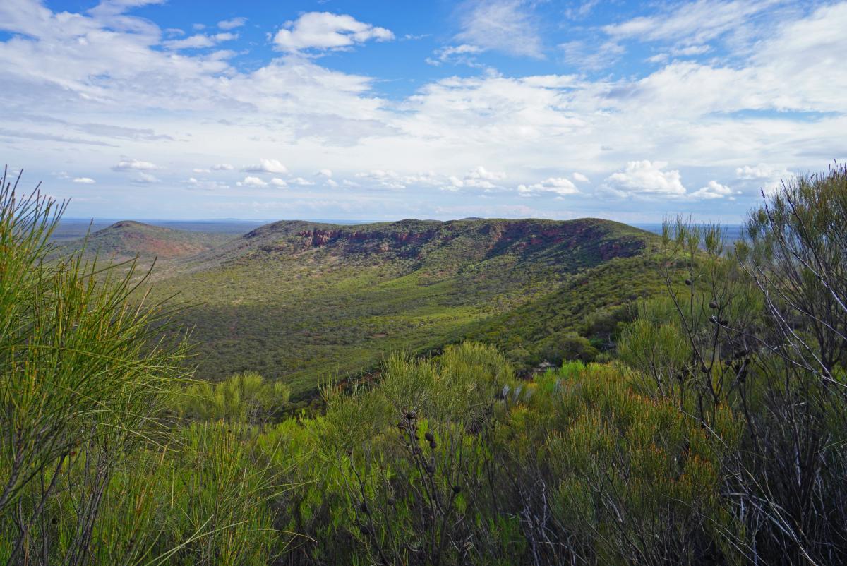
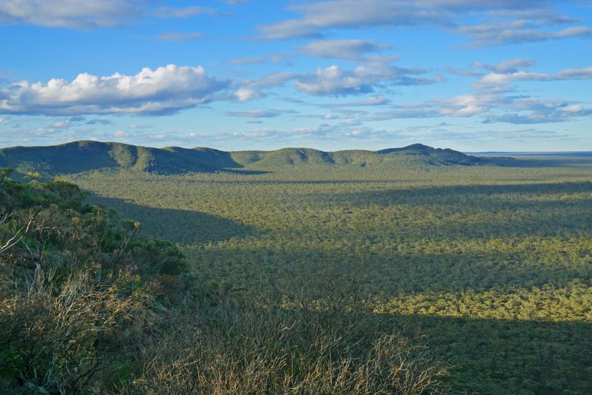
Although there are many other BIF ranges in WA, the undulating and tortuous landscape of the Helena and Aurora Range has no equal outside of the generally higher ranges over 500 km to the NW (e.g. the Weld and Jack Hill ranges). The Helena and Aurora Range also includes numerous cliffs, caves and a multitude of other impressive rock formations and exhibits a very high degree of biodiversity.
Among the many plants found on the range there are five species that grow nowhere else in the world, four of which are listed as Threatened; Lepidosperma bungalbin, Acacia shapelleae and two that grow out of the cracks and fissures in the BIF outcrops; Tetratheca aphylla subsp. aphylla and Leucopogon spectablis. There are also tall trees, including Salmon gums in the surrounding planes and Inland Wandoo (Eucalyptus capillosa subsp capillosa), that grow in small pockets on the upper slopes of the range, like mini woodlands.
There are few formed trails in the Helena and Aurora Range, so the walk options presented here are mostly off-track routes. However, due to the generally open and sparse woodland/ shrubland these routes are usually easy to follow and offer spectacular and expansive views across the range and the surrounding countryside. This contrasts with, for example, equivalent routes in the Stirling Range or other forested/ scrubland regions in the SW of WA where very thick vegetation makes off-track excursions impassable to all but the most hardened bushwalkers. It should nevertheless be appreciated that the ground underfoot, particularly on the ridgelines and peaks, is generally rocky and uneven and calls for sure footedness and good footwear.
When walking on these routes, extreme care should also be taken to avoid unnecessary trampling of the vegetation, which is often rare and fragile. Due to the generally sparse vegetation coverage this should not prove overly problematic, but there are a few places on the main ridgeline where the vegetation becomes thicker and walkers will need to carefully negotiate a minimum impact route through these areas.

Walker Safety
The Helena and Aurora Range is a remote outback location and any help, if needed, is a long way away. All bushwalking groups should be appropriately equipped with, as a minimum, adequate footwear, clothing, food and water supplies and first aid equipment. Although Telstra mobile coverage may be available from the high ridges and peaks of the range, it is recommended that a Personal Locator Beacon (PLB) should also be carried, particularly for small groups or solo walkers. Alternatively, a satellite phone would be useful, which can be hired if necessary for a modest cost.
The range is best avoided if rain is expected (or has recently occurred) since the access track from Koolyanobbing can become extremely treacherous in places after even modest rainfall, particularly if towing. Extreme care is required if accessing the northern campsite in such cases since flash flooding in the valley that separates the western hills from the main range can make the vehicle access track impassable at this point.

Walk Options – Summary
A number of walk options are presented of varying length and difficulty. The walks have been graded either ‘medium’ or ‘hard’. Although a number of the walks are quite short (half day), they are nevertheless rated ‘medium’ due to the very rough ground they often traverse. The ‘hard’ classification, has been reserved for the longer excursions with significant ascent and/ or where they traverse extremely rough ground.
Some of the best walks are quite short and are highly recommended before embarking on the longer and more arduous expeditions, particularly if you have never walked in the range before or are inexperienced in navigating off-track routes.
To aid in navigation, GPX files are presented for each of the route options presented here which can be pre-loaded into suitable GPS devices including phones with suitable mapping apps.
Note that only one peak is officially named - Bungalbin Hill, which is often mistakenly assumed to be the highest peak. However, to aid comprehension herein, informal names have been assigned to all of the main peaks.
Summaries of each walk follow with more detailed information available by clicking on the associated thumbnail picture. The walks are ordered based on their starting points, moving west to east.
Click on Map below to enlarge in separate window.

West Peak and J5 Monolith (Medium)
This route ascends some of the lower peaks to the west of the main range, but this should not deter the walker. The rocky summit of West Peak is the only peak in the range that boasts a 360 degree summit panorama and as a result offers some of the best views in the entire range, including spectacular views to the main range to the east, and over the surrounding sand plains to the Mt Jackson Range, Die Hardy Range and Mt Manning Range.
This walk also takes in the impressive J5 monolith that can be ascended with care (basic rock climbing) from its west side.
Click thumbnail below for more info.

Main Range Ridge Walk (Hard)
This is the ultimate 1-day walk in the range, traversing all the peaks on the main range from Bungalbin Hill in the west and including the Highest Peak in the range and onto the saddle where the only formed track crosses the range at Bungalbin East. This is an arduous walk with significant ascent and descent over rough ground but will plentifully reward the walker with a variety of magnificent vistas over most of the journey.
The summit of the Highest Peak is shrouded in high vegetation preventing clear views, but there is no shortage of magnificent lookout points nearby. The walk is presented here as a linear walk running west to east and requires a vehicle shuttle to get to the start. The walk as described ends at the southern campsite but could equally be conducted from a northern campsite base.
Click thumbnail below for more info.
Bungalbin Hill (Medium)
This short walk directly ascends the steep west ridge of Bungalbin Hill, which offers several vantage points presenting vistas over the western range and to Mt Jackson. The walk then descends the north ridge (with views to Die Hardy Range and Mt Manning Range) before looping back to the start via some old mining exploration tracks.
It should be noted that Bungalbin Hill is one of the few summits in the range that is shrouded in high vegetation so no views can be obtained from the summit itself although an impressive cairn marks the highest point.
Click thumbnail below for more info.

South Peak (Medium)
This short walk ascends the western ridgeline to surely the best viewpoint in the entire range. To the north, a spectacular vista unfolds over Bungalbin Hill and out to distant ranges on the horizon. To the east, the vista is even more impressive, looking out over the entire crescent shaped Main Range Ridge line. The route down follows a steep rocky route, tracking through the beautiful banded iron stone. One prominent rock feature, approximately halfway down, is a standout feature that shouldn’t be missed.
Click thumbnail below for more info.
Bungalbin East (Cliffs and Caves) and East Peak (Hard)
The Bungalbin East area hosts numerous spectacular rock formations, including cliffs, caves, rock towers and buttresses. This full day walk explores many of these features as well as ascending the second highest peak in the range. While not particularly long, the route through the rock formations is very rugged and often traverses very steep ground. Progress will be slow and you should allow plenty of time to properly explore and savour the impressive surroundings.
East Peak offers great views back over the main range and also out to the isolated North and NE peaks. After the earlier exertions, the walk back down is easy, following pre-existing trails.
Click thumbnail below for more info.

NE Peak and North Peak from the South (Hard)
This full day walk, initially follows an existing track below the Bungalbin East cliffs and caves, giving opportunities for forays up the steep SE slope to view the most prominent caves. After rounding East Peak the route traverses north across the sand plains before ascending NE Peak. This is a photographers delight offering magnificent views over North Peak, East Peak and the Main Range Ridge line.
The route follows the SW ridge down before ascending again the NE ridge of the North peak, which outlooks over Bungalbin East and the Main Range Ridge line. The return route is via the track over the saddle at Bungalbin East. These two peaks may also be climbed via a shorter route from the northern campsite.
Click thumbnail below for more info.

